
The California Street Safety Project is Complete!

The California Street Safety Project is Complete!
By Erin McMillan

You may have already noticed the fresh paint and new lane configuration on California Street from Arguello Boulevard to Park Presidio. This recently completed ‘road diet’ painted on California Street changed the lane configuration from four lanes to three with a center turn lane to help improve safety along the corridor. 

Man walking in crosswalk in front of a bus
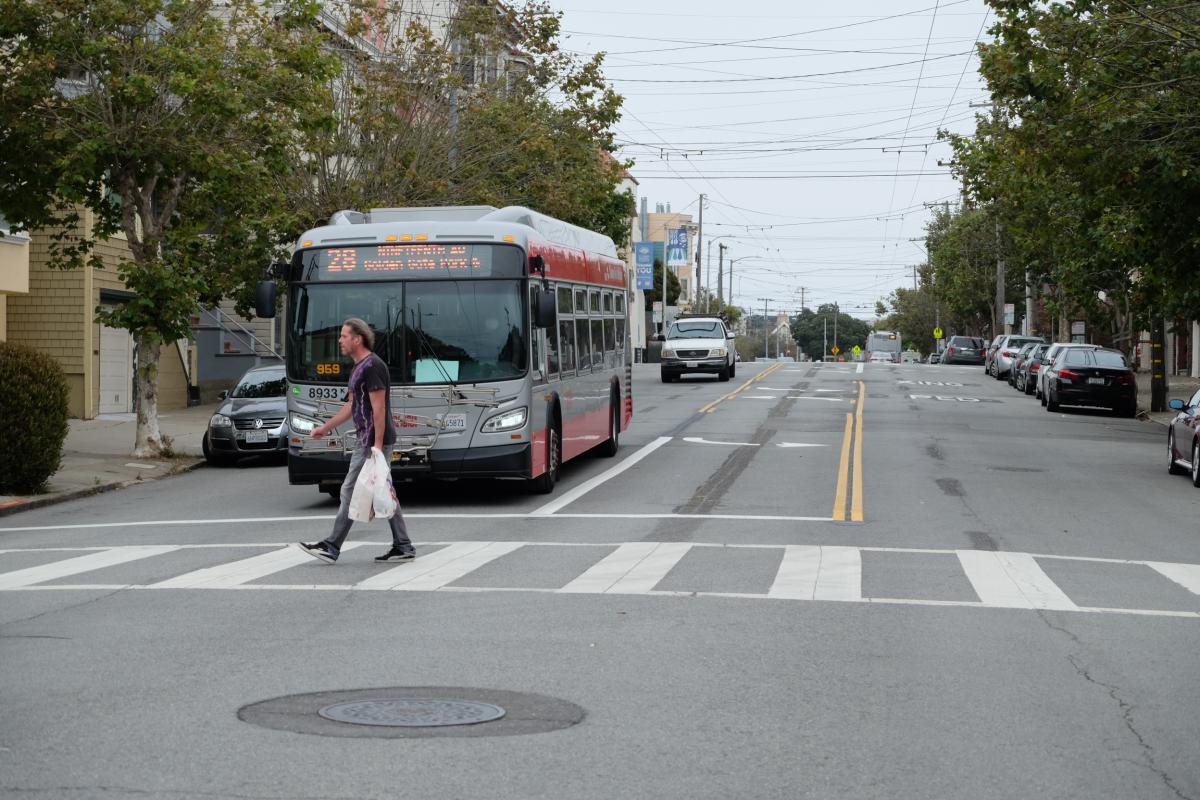
California Street and 10th Avenue post-construction

This was the final safety element to be implemented as part of the California Street Safety Project, which began earlier this year with “daylighting” to increase visibility at intersections.  

Why a road diet on California? 

California Street is part of the city’s Vision Zero high-injury network -- the 13% of city streets that account for 75% of severe and fatal collisions. 

This section of California had 73 injury collisions in five years with 7 involving pedestrians. In addition, there have been 35 Muni-involved collisions, many due to narrow lanes. 

  • Road diets reduce speeding and risk of collision by reducing the number of lanes 
  • Wider lanes provide room for safer operation of Muni vehicles 
  • A separate turn lane allows turning traffic to be separate from traveling traffic  
  • Fulton Street: Road diet reduced collisions by over 40%  
  • 25th Avenue: Road diet reduced collisions by 20%   

Earlier this year, several safety elements for pedestrians were installed, including:   

  • Daylighting: Red painted curbs at intersection approaches to improve visibility for all road users 
  • Higher visibility zebra-striped continental crosswalks 
  • Updated pavement markings 

Construction crews working at California and 6th
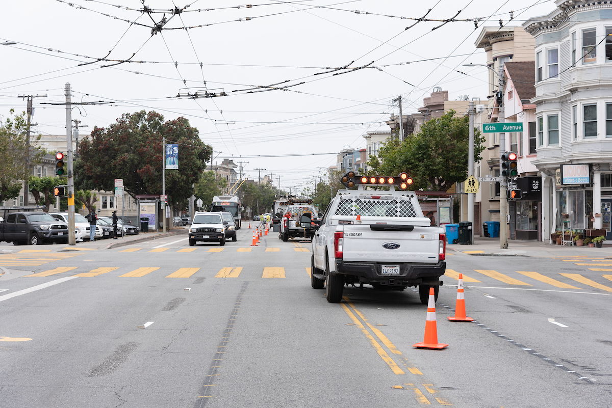
Construction crews working at California Street and Sixth Avenue pre-construction

Starting this fall summer, we’ll begin the evaluation of the project. The evaluation will include traffic and street-level data, such as tracking changes in collisions, traffic volumes on California and side streets, and driving behavior. In addition to traffic and street-level data collection, we’ll be collecting experiential feedback from neighbors via email. Given the impacts of COVID-19, we’ll also be waiting to collect some post-implementation data until the city’s traffic returns to pre-COVID levels. 

We also received extensive feedback during project outreach in 2019 and will be using that input to shape our evaluation and monitoring of the project. Thank you to everyone who chimed in on this important project and we that will improve the area for years to come. 

To learn more, visit www.SFMTA.com/CaliforniaSafety. Want to give your feedback on any element of the California Street Safety Project? Email us at CaliforniaSafety@SFMTA.com


Published August 13, 2020 at 06:31PM
https://ift.tt/3g1lcko

Comments

Popular posts from this blog

Reconnecting San Francisco Across Streets and Freeways

Reconnecting San Francisco Across Streets and Freeways By With limited space on San Francisco city streets, how can we ensure that current and future transportation options remain accessible and affordable to all? The San Francisco County Transportation Authority (SFCTA), the SFMTA and the San Francisco Planning Department are collaborating through ConnectSF in creating a template for an equitable, sustainable and effective future. Their Streets and Freeways Strategy examines approaches that support San Francisco’s Transit-First , Vision Zero , climate action , and equity goals .  The strategy complements the Transit Investment Strategy released in April 2021. SFMTA staff provided expertise in developing the strategy and is leading the Active Transportation component, exploring ways to build a connected network of bike and pedestrian routes across the city that make biking and walking safe and enjoyable. SFMTA staff from across the agency also developed strategies to ma

Chinatown Connects to Muni Metro

Chinatown Connects to Muni Metro By Deanna Leo With the completion of Central Subway, customers will be able to ride the T Third Muni Metro all the way from Visitacion Valley to Chinatown. Starting November 19, when Muni Metro riders can first take Central Subway's special weekend service to Chinatown,  prepare to spend the day in Chinatown enjoying all its sights, sounds and flavors. There is so much to explore in the largest Chinatown outside Asia! Tourist attractions include the Dragon’s Gate, Old St. Mary’s Cathedral and Portsmouth Square, the site of San Francisco’s original customs house where today, members of the Chinese community spend the days singing or playing mahjong, a traditional and very popular tile-based game. Fans of Amy Tan’s novel, The Joy Luck Club, can meander the streets of Chinatown searching for the places where her story unfolds. On Wavery Place you can visit the First Baptist Church where the four mothers in the story meet to play mahjong. Muni M

Have Feedback on the COVID-19 Muni Temporary Service Plan?

Have Feedback on the COVID-19 Muni Temporary Service Plan? By Shalon Rogers In March 2020, due to unprecedented constraints on resources brought on by the COVID-19 pandemic, the SFMTA had to make significant transit service reductions. As of January 2021, the agency has been able to restore service to a level where 91% of San Franciscans are within a quarter mile of a transit stop. This is reflected in the SFMTA’s current  COVID-19 Temporary Service Plan .   ' COVID-19 Temporary Service Plan Map The SFMTA is committed to ensuring that our programs and services are  compliant with Title VI of the Civil Rights Act of 1964  and therefore do not have a discriminatory impact based on race, color or national origin. As part of this work, we conducted a Title VI service equity analysis to evaluate the current COVID-19 Temporary Service Plan. The results of this analysis will be presented to the MTA Board of Directors on May 4. The public is invited to attend and provide comments on