By Benjamin Barnett

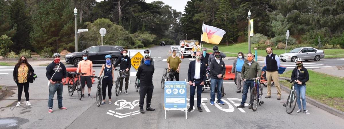
Last week, the Golden Gate Park Slow Streets Expansion opened to the public. People walking, biking, running and skating can now enjoy a nearly car-free route from the Panhandle all to the way to Ocean Beach.
Connecting the City
Golden Gate Park Slow Streets are a collaboration between the SFMTA and the Recreation and Park Department. These new Slow Streets provide the last link in a route prioritized for people on bikes stretching from the Ferry Building to the ocean by connecting to the network of bikeways, Slow Streets, and streets previously closed during the health emergency. Starting from the Ferry Building you may now head down a Car-Free Market Street, then up the hill on the Page Slow Street connecting you to Golden Gate Park's newly expanded network.
Golden Gate Park Slow Streets will begin at Stanyan Street and John F. Kennedy Drive East on the park’s eastern edge and connect with the stretch of JFK from Kezar Drive to Transverse Drive. The route then continues onto Overlook Drive, then Middle Drive and Martin Luther King Jr. Drive to Ocean Beach, where it connects with The Great Highway. The Great Highway has also been closed due to the pandemic, and this connection creates a continuous, family-friendly path from the Panhandle to the San Francisco Zoo.

Not Entirely Car-Free
To keep nearby traffic moving and maintain access for those that need to access the park in a car, a few areas are not entirely car-free:
- A 200-foot portion of the route on Transverse Drive, between JFK Drive and Overlook Drive
- An approximately half-mile portion of the Metson/Middle Drive/MLK Drive loop near the south end of the Polo Field
- The intersection at MLK Drive and Chain of Lakes Drive/41st Avenue
- A 500-foot stretch of MLK Drive near Lincoln Way
In addition, authorized vehicles intended for park maintenance and ranger patrols will use the roads along the route when necessary. Motorists can still drive through the park from north to south using Transverse Drive, Chain of Lakes Drive, and 25th Ave/Crossover Drive/19th Ave/Park Presidio, as usual.
New Traffic Flows
Drivers will be rerouted from some east and westbound roads during Golden Gate Park Slow Streets, including:
- The west portion of MLK Drive west of Sunset Boulevard, specifically from the Middle Drive/MLK loop to Lincoln Way, is closed to regular traffic. This includes Bernice Rodgers Way, between MLK Drive and JFK Drive.
- Overlook Drive and Middle Drive, between Transverse Drive and the Metson/Middle Drive/MLK loop, will be closed to traffic. However, Middle Drive between Transverse and Overlook will remain open and available for street parking.
- JFK Drive, between Kezar Drive and Transverse Drive, will remain closed to traffic. This portion of the road had previously been closed during the City’s initial COVID-19 response.
Golden Gate Park Slow Streets and the SFMTA Slow Streets initiative have the common goal of making San Francisco more welcoming and accessible for people who want to travel on foot, bicycle, wheelchair, scooter, skateboard or other forms of micromobility. Slow Streets are critical infrastructure that attracts users of the full array of neighborhood demographics—including children, older adults, people with disabilities and people of color.
Published September 24, 2020 at 10:26PM
https://ift.tt/2HvxBBq
Comments
Post a Comment