Improving Pedestrian Safety and Access for Lake Merced

Improving Pedestrian Safety and Access for Lake Merced
By Adrienne Heim

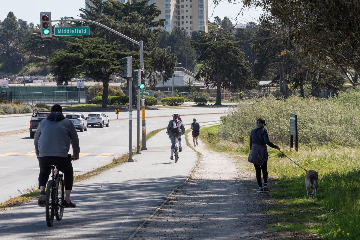
Photo of Lake Merced Boulevard with pedestrians, bicycle riders and cars

Lake Merced is a popular recreational destination

Help Us Prioritize and Identify Needed Safety Improvements

The Lake Merced Pedestrian Safety Project is studying potential improvements for pedestrian safety and access along Lake Merced Boulevard between Sunset Boulevard and John Muir Drive. Situated in San Francisco’s southwestern corner, Lake Merced Boulevard has a history of collisions, including those between vehicles and pedestrians, and between vehicles and bicycles. Lake Merced Boulevard between Font and Sunset boulevards is part of San Francisco's Vision Zero High Injury Network (HIN), where 75% of the city's traffic injuries and fatalities occur on just 13% of its streets.

Surrounded by major recreational, education, and shopping destinations, the boulevard is a major route for Lake Merced Park, San Francisco State University, Lowell High School, Lakeshore Elementary School and Stonestown Galleria. Lake Merced Boulevard is also an official city bicycle route where cyclists can either use the bike path around the lake or share the roadway with drivers on the north side of the street.
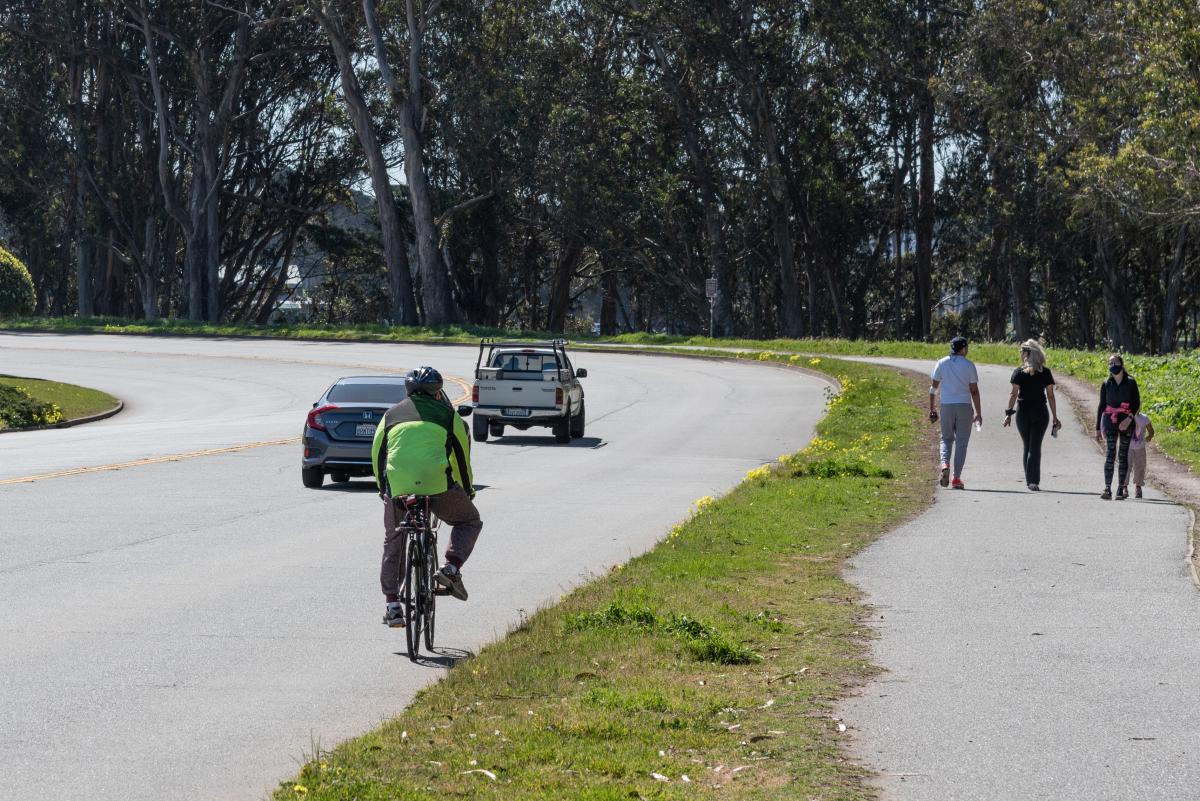
Photo of people walking and biking, with cars passing by on Lake Merced Boulevard

People walking and biking on Lake Merced Boulevard

Over a 5-year period (between 2015 to 2020) a total of 106 collisions were reported on the boulevard between Skyline Boulevard and John Muir Drive. Of those, nine were bicycle-vehicle collisions and four were vehicle-pedestrian collisions.
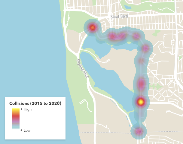
Map of Vehicle, Bicycle and Pedestrian Collisions from 2015 to 2020 on Lake Merced Boulevard from Skyline Boulevard to John Muir Drive

Vehicle, Bicycle and Pedestrian Collisions from 2015 to 2020 on Lake Merced Boulevard from Skyline Boulevard to John Muir Drive

Participate in Our Virtual Open House

From June 8 to June 22, we are inviting feedback from community members who live, work, and/or travel around Lake Merced Boulevard through our interactive virtual open house (available in English, Chinese and Spanish).  You can learn more about the project and provide comments during the event, which can be accessed at any time during the open house period.

In July, we will review the steering committee and community’s feedback and produce a Community-Based Transportation Plan (CBTP) that highlights recommendations for improvements, preliminary conceptual designs, and a feasible implementation plan that reflects community needs and desires.

We also encourage you to take the Lake Merced Pedestrian Safety Survey on the website or by placing your cell phone camera over the QR code.

QR code for open house survey

The survey will be open until June 22. 

The planning process for this project includes a monthly steering committee that consists of neighbors and stakeholders to help staff better understand current walking patterns, barriers, and opportunities to improve pedestrian connections to and from Lake Merced Park and nearby transit stops. Learn more about the project and subscribe to project updates by visiting our Lake Merced Pedestrian Safety Project, Making Access Around Lake Merced Safer and More Pleasant website.


Published June 08, 2021 at 04:47PM
https://ift.tt/3g1nymk

Comments

Popular posts from this blog

Reconnecting San Francisco Across Streets and Freeways

Reconnecting San Francisco Across Streets and Freeways By With limited space on San Francisco city streets, how can we ensure that current and future transportation options remain accessible and affordable to all? The San Francisco County Transportation Authority (SFCTA), the SFMTA and the San Francisco Planning Department are collaborating through ConnectSF in creating a template for an equitable, sustainable and effective future. Their Streets and Freeways Strategy examines approaches that support San Francisco’s Transit-First , Vision Zero , climate action , and equity goals .  The strategy complements the Transit Investment Strategy released in April 2021. SFMTA staff provided expertise in developing the strategy and is leading the Active Transportation component, exploring ways to build a connected network of bike and pedestrian routes across the city that make biking and walking safe and enjoyable. SFMTA staff from across the agency also developed strategies to ma

Have Feedback on the COVID-19 Muni Temporary Service Plan?

Have Feedback on the COVID-19 Muni Temporary Service Plan? By Shalon Rogers In March 2020, due to unprecedented constraints on resources brought on by the COVID-19 pandemic, the SFMTA had to make significant transit service reductions. As of January 2021, the agency has been able to restore service to a level where 91% of San Franciscans are within a quarter mile of a transit stop. This is reflected in the SFMTA’s current  COVID-19 Temporary Service Plan .   ' COVID-19 Temporary Service Plan Map The SFMTA is committed to ensuring that our programs and services are  compliant with Title VI of the Civil Rights Act of 1964  and therefore do not have a discriminatory impact based on race, color or national origin. As part of this work, we conducted a Title VI service equity analysis to evaluate the current COVID-19 Temporary Service Plan. The results of this analysis will be presented to the MTA Board of Directors on May 4. The public is invited to attend and provide comments on

Chinatown Connects to Muni Metro

Chinatown Connects to Muni Metro By Deanna Leo With the completion of Central Subway, customers will be able to ride the T Third Muni Metro all the way from Visitacion Valley to Chinatown. Starting November 19, when Muni Metro riders can first take Central Subway's special weekend service to Chinatown,  prepare to spend the day in Chinatown enjoying all its sights, sounds and flavors. There is so much to explore in the largest Chinatown outside Asia! Tourist attractions include the Dragon’s Gate, Old St. Mary’s Cathedral and Portsmouth Square, the site of San Francisco’s original customs house where today, members of the Chinese community spend the days singing or playing mahjong, a traditional and very popular tile-based game. Fans of Amy Tan’s novel, The Joy Luck Club, can meander the streets of Chinatown searching for the places where her story unfolds. On Wavery Place you can visit the First Baptist Church where the four mothers in the story meet to play mahjong. Muni M